REWET Open Lab 1
Weerribben Wieden National Park, The Netherlands
Location:
Weerribben Wieden National Park, Kiersche Wijde West; Municipality of Steenwijkerland; Province of Overijssel; Netherlands.
Type of wetland:
Peatland
Size:
Restoration area ~100 ha, total natural area park ~11000 ha
Site manager:
Natuurmonumenten
OL coordinator (organisation and country):
Wageningen Environmental Research, Netherlands
Peatland Restoration in Weerribben Wieden
Transforming Weerribben Wieden: Europe's Largest Peatland Under Restoration
The area of the Weerribben Wieden National Park contains the largest continuous peatland in north-west Europe (over 10.000 ha) and it has suffered intervention by peat extractors.
The landscape as it is present today has been formed by centuries of human intervention, especially the excavation of peat and reed cutting. Characteristic of the area is the presence of a landscape mosaic, with habitats in different stages of terrestrialization, representing a vegetation succession sequence from open water to bog woodland. These gradients, with many water-land interfaces, contain a species rich flora and fauna. However, the parks’ habitats are threatened by hydrological disturbances and water quality issues. The first steps towards restoration were taken in 1930, becoming an example of successful peatland restoration on a regional scale. It is now considered an European hotspot for endangered mosses, vascular plants, dragonflies, and butterflies. Restoration is ongoing, and the site comprises one of the most recent restoration projects, which aims at increasing fen biodiversity.
Hydrological Restoration Efforts
Reviving Wetlands: Innovative Hydrological Solutions in Action

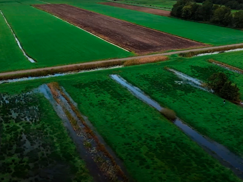
Part of the area was used as agricultural grassland until 2002. After abandoning the agricultural practices, the grasslands were mowed yearly followed by sheep grazing to facilitate the reestablishment of fen vegetation. This approach was not successful, likely due to the negative effects of lowered water tables and excess nutrients, unfavourable conditions for wetland vegetation development.
In 2022, to restore the hydrological situation, nutrient-poor mineral-rich (water quality has improved over the years) surface water was pumped in the wetland to increase the water level, resulting in higher water tables and periodic flooding in winter. The reduction of wetland soil nutrients is facilitated via repeatedly mowing of the vegetation present and removal of the harvested biomass. Also, to facilitate vegetation succession from open water to land, new peat pits are excavated in the area.
REWET Project: Peatland Revival
Evaluating Restoration Success: The REWET Project's Holistic Approach to Peatland Recovery
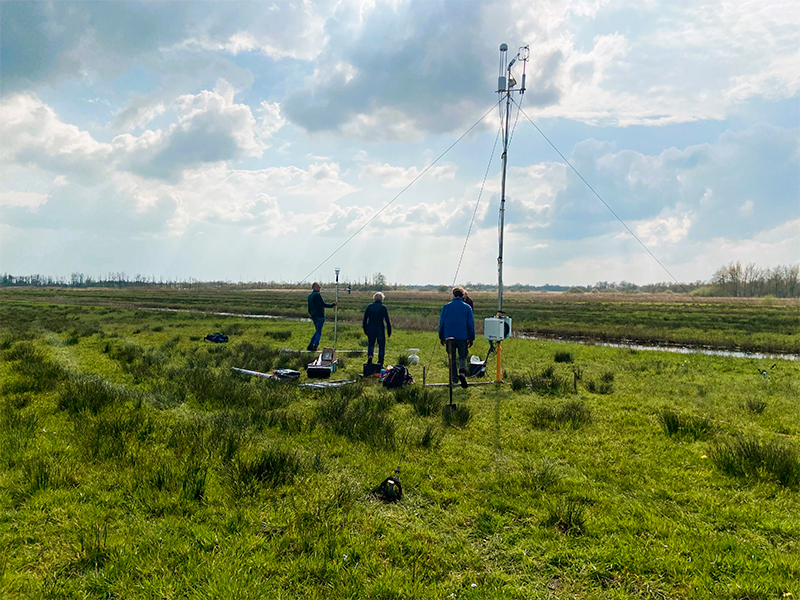
Within the REWET project, natural water levels will be reestablished, also including periodic flooding. Vegetation will be mowed to reduce wetland soil nutrient levels. The main objective of the restoration within the REWET project will be to evaluate the effect of restoration, measuring abiotic variables, biodiversity, and greenhouse gas emissions on local to regional scale. Using this knowledge together with other Open Labs, we aim to design large-scale, integrated, nature-based combinations of peatland restoration measures
Thanks to the presence of a hiking trail, the site is accessible on foot, in contrast to many other parts of the area which can only be visited by boat. This provides the opportunity to match biodiversity restoration and recreational goals. It also serves an educational purpose, as it is an educational nature trail that will be valorised in the REWET project.